
Center for Geosciences

LSC Center for Geosciences: https://arcg.is/e9ume

The LSC Center for Geosciences is a resource for faculty and students interested in research applications of geospatial technology and Unmanned Aircraft Systems (UAS) for mapping and remote sensing.
OpenGEO Project: The LSC Center for Geosciences started a new community-based shared open data/open science initiative. Details to come.

Lone Star College-CyFair Campus
UAS Drone Mapping: “from flights to insights”
Earth Observation Science: Unmanned Aircraft Systems (UAS) imagery:

Image (Buck Buchanan): Carrie Bow Caye, Belize. Smithsonian Institute Coral Reef Research Station. LSC-CFair Belize Study Abroad Summer 2016.
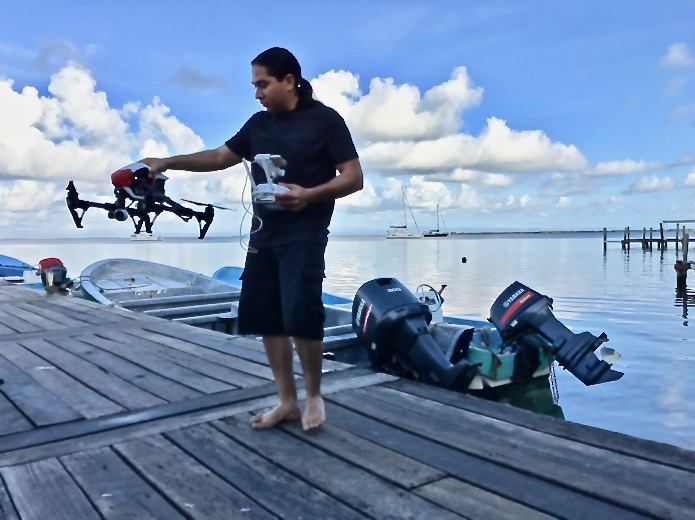 Mario Torres, Physical Geography Study Abroad. Program focus: Social & Ecological Sustainability. South Water Caye, Belize 2016
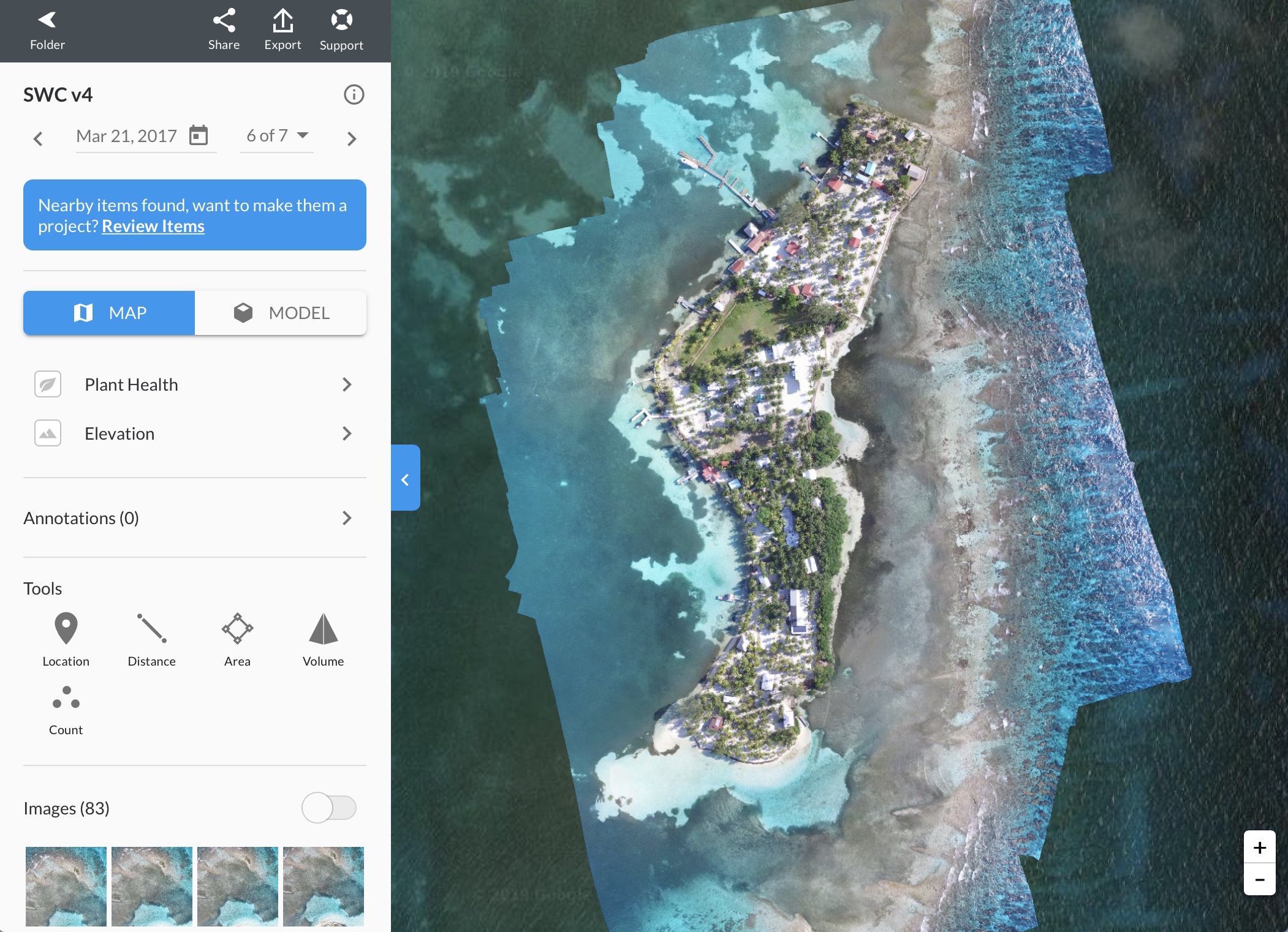 Image (Buck Buchanan): South Water Caye, Belize. LSC-CFair Belize Study Abroad Summer 2016. LSC Center for Geosciences vegetation health and coastal erosion study – looking at the impact of mangrove health as a stabilizing factor.
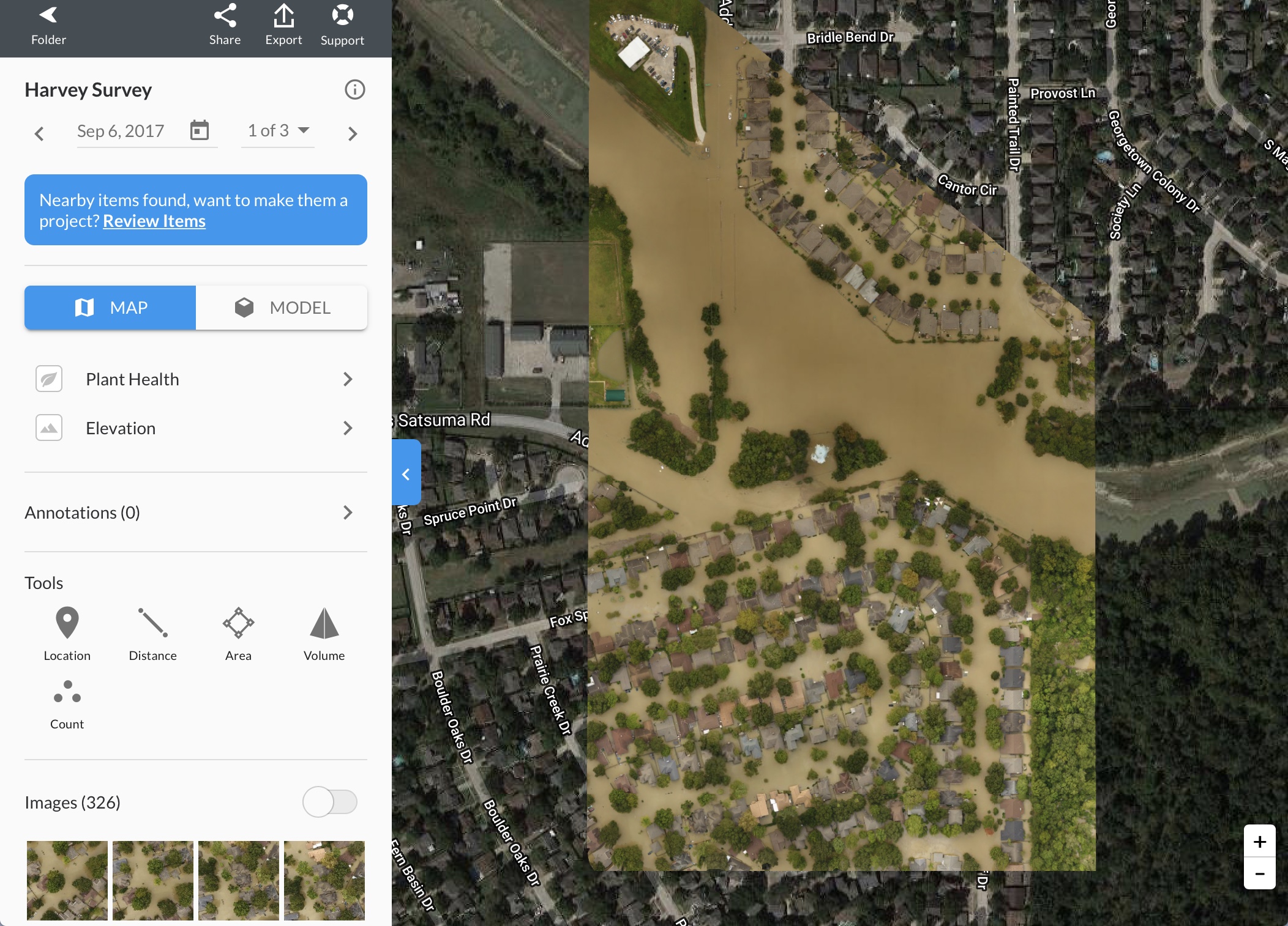 Image (Buck Buchanan): Langham Creek, Addicks Reservoir 2017. LSC Center for Geoscience Hurricane Harvey flood analysis.
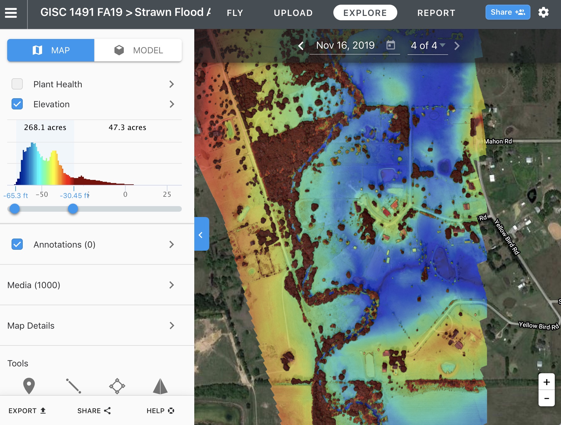
Image (Buck Buchanan): Honors College Research Project:“Exploring the Applications of Unmanned Aircraft Systems (UAS) for Flood Analysis and Assessment” Fall 2019. Brenna Strawn. Flood assessment in Waller, TX.
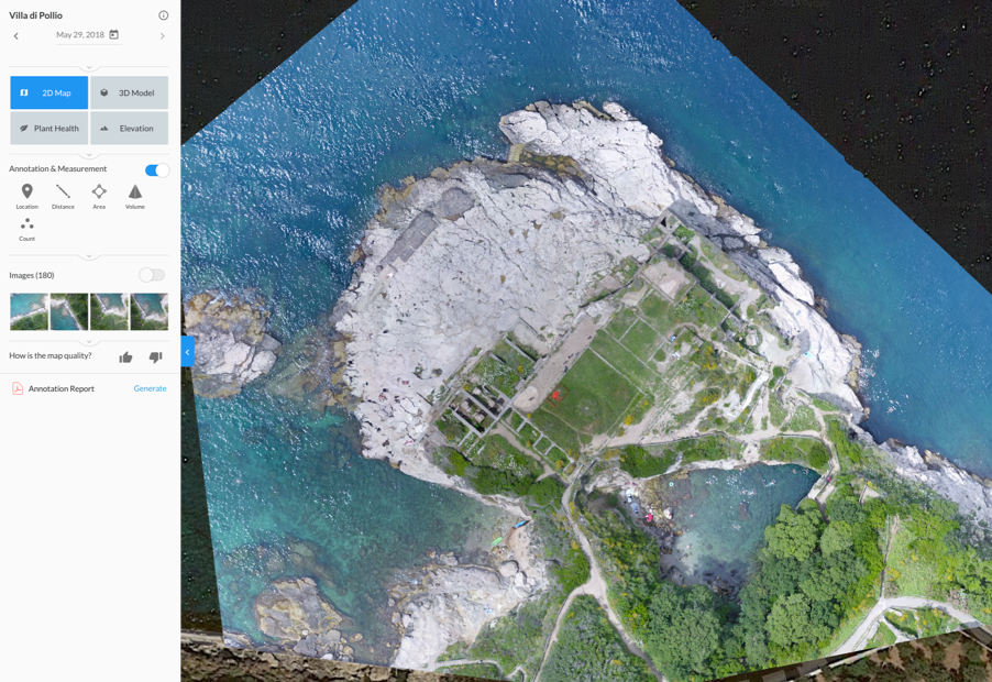 Image (Buck Buchanan): Italy Study Abroad 2018, Villa di Pollio Roman Ruins and archaeology site, Sorrento, Italy Aerial Survey: LSC Center for Geosciences historical site analysis
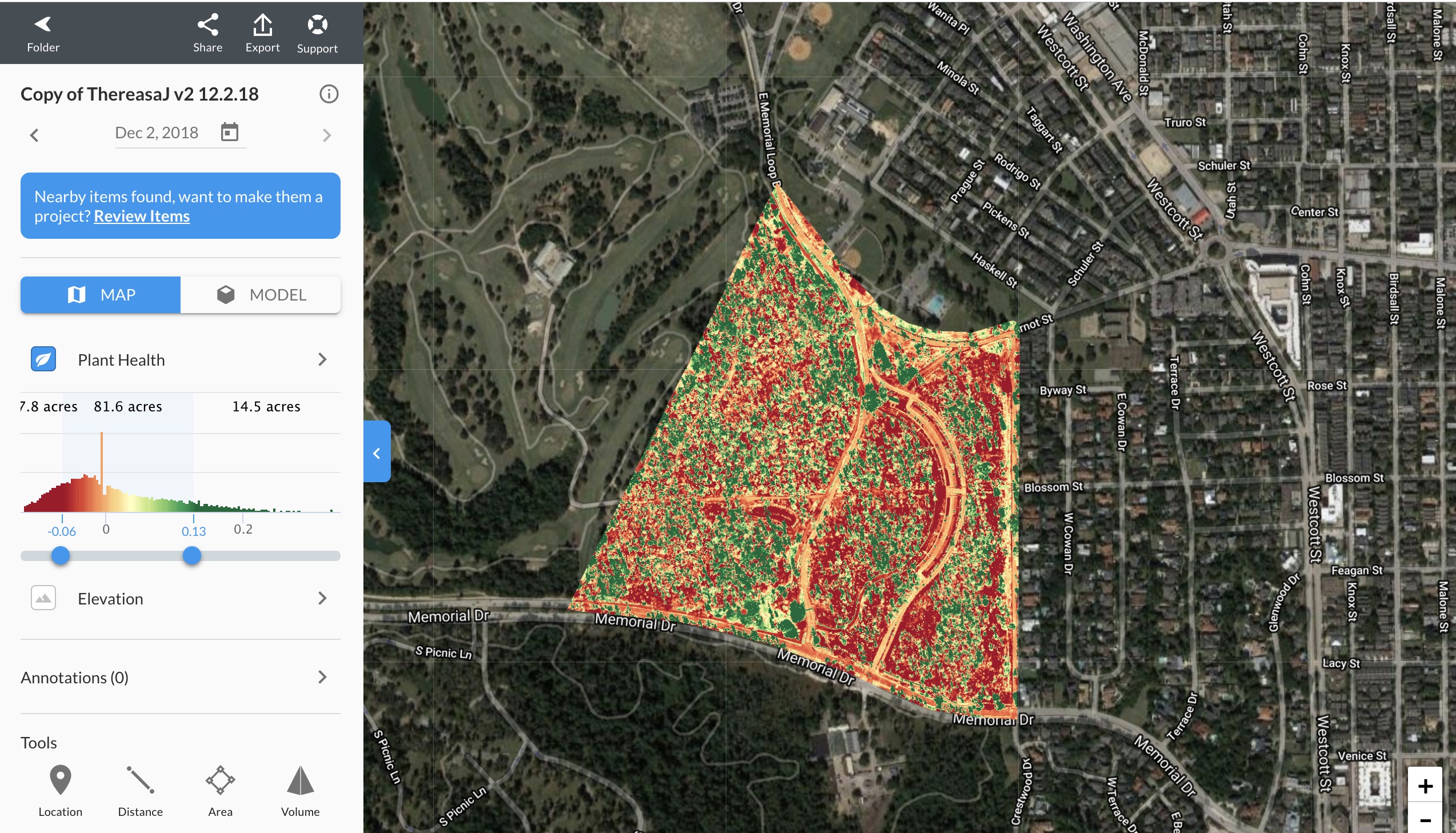 Image (Buck Buchanan): GISC students aerial survey, Memorial Park vegetation health study made possible through a partnership with the Memorial Park Conservancy (MPC).
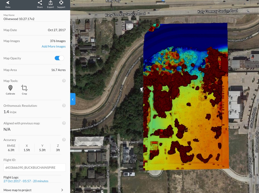 Image (Buck Buchanan): ANTH and GEOG students aerial survey, Olivewood Cemetery digital surface modeling (to examine erosion) made possible through a partnership with Dr. David Bruner (ANTH) and the Descendants of Olivewood (UNESCO World Heritage recognized site).
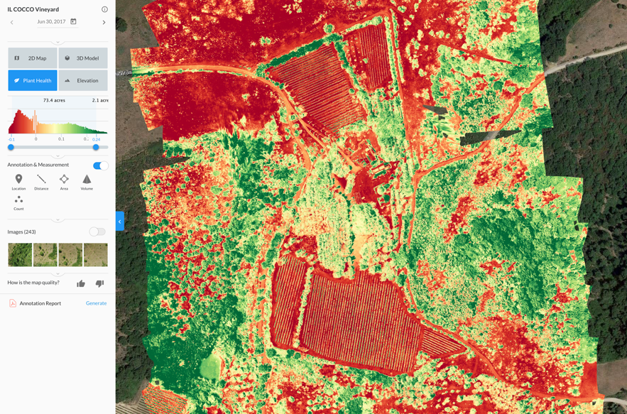 Image (Buck Buchanan): Italy Physical Geography Study Abroad 2017, IL Cocco Vineyard, Montalcino, Tuscany, Italy. Agriturismo Vineyard Vegetation Study: LSC Center for Geosciences
Sample Honors research supported by the LSC Center for Geosciences:
- Hanna Robbins, GEOGH 1303 World Regional Geography, Honors Project/Presentation Title: “Airport Geography & Aircraft Approaches Aviation: Roles in Geography,” Advisor: Buck Buchanan (GEOG), Fall 2020
- Brenna Strawn, Honors Project/Presentation Title: “Wildlife Management Surveys: A Comparison of Traditional Game Count Methods and Unmanned Aircraft Systems (UAS) Based Methods,” Advisor: Buck Buchanan (GISC), Spring 2020
- Felicia Whalen, GISC 1491 Special Topics in Cartography, Honors Project/Presentation Title: “Comparing Geospatial Technology Methods for Producing 2D and 3D Models of Historic Churches,” Advisor: Buck Buchanan (GISC), Fall 2019
- Brenna Strawn, GISC 1491 Special Topics in Cartography, Honors Project/Presentation Title: “Exploring the Applications of Unmanned Aircraft Systems (UAS) for Flood Analysis and Assessment,” Advisor: Buck Buchanan (GISC), Fall 2019
- Andrea Russ, Honors Project/Presentation Title: “What’s In Our Park Waters: A Field Exploration” Advisor: Buck Buchanan (GEOG), Spring 2018
- Marco Chacon-Olivares, Honors Project/Presentation Title: “Should Further Growth be Regulated by New Zoning Laws to Prevent Future Floods?,” Fall 2017
- Kenneth Purcell, Honors Project/Presentation Title: “Aerial Mapping and Ground Penetrating Radar Survey of the Olivewood Cemetery,” Advisor: Dr. David Bruner, Co-Advisor: Buck Buchanan (GEOG), Fall 2017
- Melissa Reinsch, Honors Project/Presentation Title: “Closing the Gap: Addressing the Learning Gap Through the Integration of Didactic Teaching and Experiential Learning,” Advisor: Buck Buchanan (GEOG), Spring 2017
- Marco Chacon-Olivares, Honors Project/Presentation Title: “What Factors Have Increased the Rate of Occurrence of Floods in the Bear Creek Village Area in the Last 50 Years,” C0-Advisor: Buck Buchanan (GEOG), Spring 2017
- Kenneth Purcell, Honors Project/Presentation Title: “Benefits of Non-Intrusive Technology used for Cemetery Surveys: Analysis of Drone Thermal Imaging and Ground Penetration Radar for Olivewood Cemetery,” Advisor: Dr. David Bruner, Co-Advisor: Buck Buchanan (GEOG), Spring 2017
- Kenneth Purcell, Honors Project/Presentation Title: “Ground Penetrating Radar and Thermal Imaging in Detecting Unmarked Graves,” Advisor: Dr. David Bruner, Co-Advisor: Buck Buchanan (GEOG), Spring 2017
- Paulina Fernandez, Honors Project/Presentation Title: “Preserving Historic Cemetery Landscapes with 360° and 270° Camera Technology,” Advisor: Dr. David Bruner, Co-Advisor: Buck Buchanan (GEOG), Spring 2017
- Kylie Monet, Honors Project/Presentation Title: “Applied Use of Unmanned Aerial Systems (UAS) in First Response to Natural Disasters and Crisis Areas,” Advisor: Buck Buchanan (GEOG), Fall 2015
- Amber Stark, Project/Presentation Title: “Drones: The New Perspective of Intelligence,” Advisor: Buck Buchanan (GEOG), Spring 2015
Fall 2015 Honors Project/Presentation:
“Applied Use of Unmanned Aerial Systems (UAS) in First Response to Natural Disasters and Crisis Areas.”
After serving her country in the Marine Corps, Kylie is completing her degree in Geographic Information Systems (GIS) at LSC-CyFair. This Fall she is working on a joint geospatial project in GIS and Geography utilizing orthophotography with Unmanned Aerial Vehicles (UAV’s). Kylie comes from a family of first responders and will be exploring practical applications in the use of UAV’s as a ‘first response’ to disaster areas. She is investigating ways in which emergent UAV technology can increase the efficiency and safety of search and recovery efforts. She is a key member of the LSC-CyFair GeoVisualization Lab and has been piloting test flights of our new UAV equipment. More on this project to follow.
Kylie Monet was instrumental in our UAS program and her work helped start the LSC Center for Geoscience.
Video: Lone Star College Fire Science Burn Building Test Flight
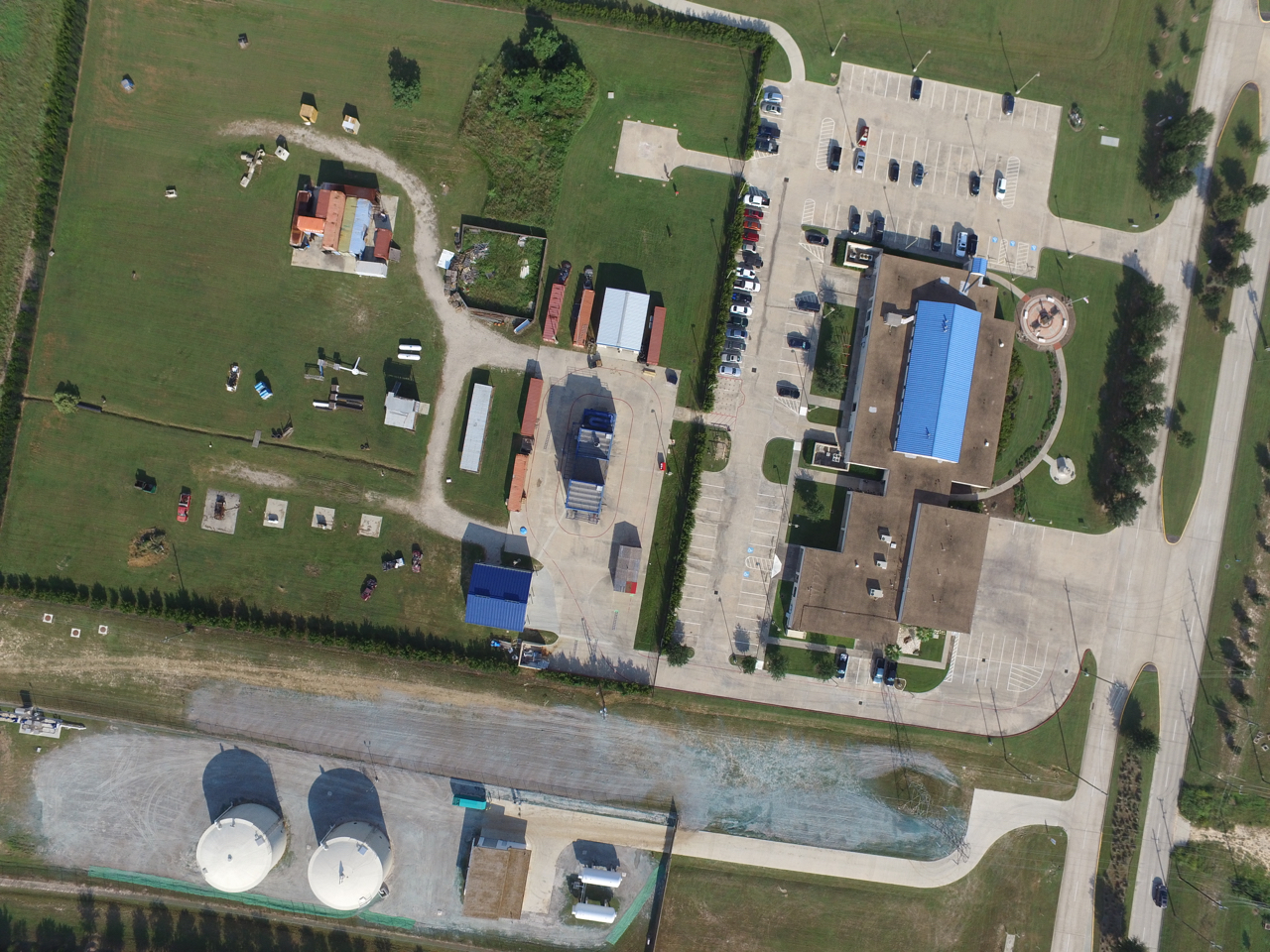
Lone Star College-CyFair Fire Science Technology Dept.
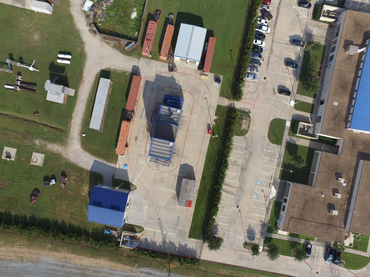
LSC-CyFair Four Story Burn Tower (centered)
LSC-GeoVis Tumblr: http://lsc-geovis.tumblr.com
Contact:
Buck Buchanan (GEOG/GISC, LSC Center for Geosciences)
Michael Konvička (GISC, Dept. Chair, Geosciences)
David Bruner Ph.D. (ANTH)